Before Boston was a memory, it was a place to build a life.
In 1865, slavery ended in Kentucky. But freedom did not come with a house key. It did not come with a piece of ground, a school for your children, or wages you could count on.
Those things still had to be built.
For Black Kentuckians, emancipation changed the law. The work of making a life beyond slavery would reach into every part of the years that followed: where a family could live, what it could earn, what its children could learn, and what it could leave behind.
In Georgetown, one part of that story took shape in a neighborhood called Boston. People also remember it as The Bottom. Here, the history of freedom became the history of particular streets, particular houses, and people whose names still belong to the families telling the story.
There is no single surviving page that tells us everything about Boston’s beginning. We find it a little at a time. A name in a deed. A lot on a map. A household written down by a census taker. Together, those pieces begin to return a neighborhood to view.
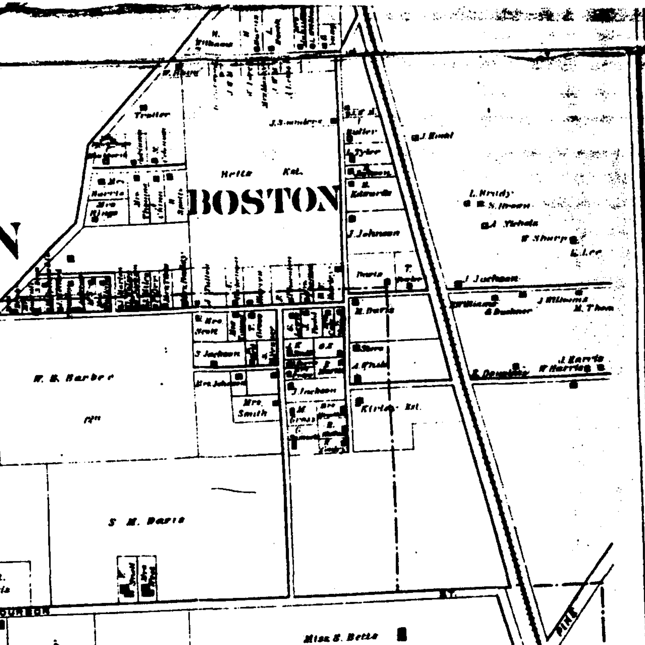
1879 BOSTON ON THE MAP
Authentic archival map detail · Beers & Lanagan, Scott County, 1879.
CHAPTER TWO · THE FIRST GROUND
A piece of land. A stake in tomorrow.
Two years after emancipation, the paper trail begins to sharpen. A Georgetown history study points to an 1867 land transaction involving Morrison, James Jackson, Moses Jackson, Jonas A. Jackson, and Warren M. Spotts.
For now, those names take us to a deed-book reference. They also remind us that the making of Boston involved people making decisions about land at the very beginning of freedom.
By 1879, Boston appears on a map. Other records lead to Lewis West’s addition and, across later decades, to purchases along Brown and Payne streets. What looks small on paper—a lot, a boundary, a line along a road—could hold a family’s plans for years to come.
The neighborhood did not arrive all at once. Its history accumulated, parcel by parcel and generation by generation.
Look closely at an old map. Behind every boundary line, someone was imagining a future.
REFLECTION ON BOSTON’S LAND HISTORY
CHAPTER THREE · 1894–1896
A neighborhood needs somewhere to gather.
A home could shelter a family. A church and a school could help hold a community together.
During the 1890s, two land purchases along Chambers Avenue left a lasting mark on Boston. The first was for education. On April 23, 1894, according to the Georgetown history study, Samuel M. and Alice Davis sold land to the Georgetown Board of Education for $900.
The same study reports that on May 2, 1896, Samuel and Alice Davis sold a 60-by-100-foot lot for Wayman Chapel African Methodist Episcopal Church.
The study lists six trustees in the church transaction: James Miles, Winston Lindsay, Augustus Thomas, George Williams, William Henderson, and James Wilkins.
It is worth pausing over them. Institutions can become familiar landmarks, their beginnings reduced to a date. But here were six people accepting responsibility for a place that others would depend on. Their names belong in the story beside the building’s.
The little brick church.
Wayman Chapel became a familiar presence on Chambers Avenue. Known locally as “Little Brick,” it remains part of Boston’s living landscape at 321 Chambers Avenue.
The lot purchase tells us when this piece of ground entered the church’s history. It does not, by itself, tell us when the congregation first began. That earlier story still asks to be recovered.
What we can follow is a connection reaching into the present. In 2026, Georgetown’s Emancipation Day announcement named Wayman Chapel and the Scott County African American Heritage Association as partners in a celebration of history, faith, and family. More than a century after those trustees’ names were recorded, the church was still helping bring people together.
CHAPTER FOUR · A FUTURE WORTH LEARNING FOR
Every child carried a possibility.
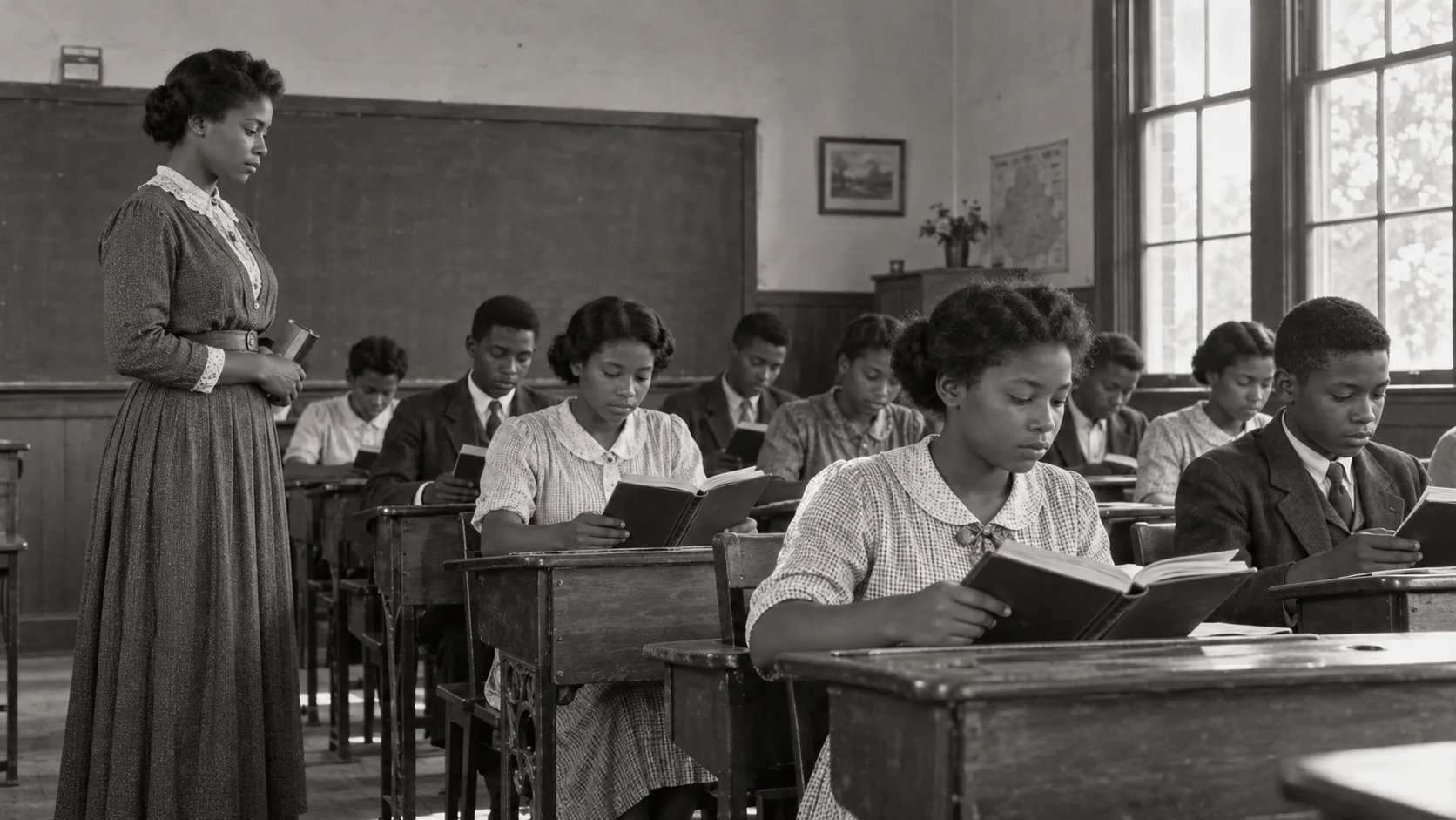
Circa 1925 · Historical interpretation. Imagined classroom and people; not Ed Davis School’s documented interior.
CHAMBERS AVENUE SCHOOL · ED DAVIS SCHOOL
And here, possibility had teachers.
In a segregated Kentucky, a Black child’s education took place within limits imposed by law and custom. The school on Chambers Avenue became one of the places where teachers and families worked toward a larger future.
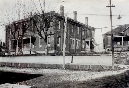
The Kentucky Historical Society dates the school building to 1894. Charles Steele served as its first principal. In 1908, Edward B. Davis became principal, beginning a period of growth that would leave his name on the school itself.
A two-year high-school course began in 1911. A four-year course followed in 1924. Those dates mark more than changes to a course catalog. They meant that young people could carry their education further here, in the community they knew.
In 1929, the school was renamed for Ed Davis.
FROM THE ARCHIVE · Ed Davis High School Georgetown–Scott County Museum. Photographer and date unidentified.
After his death in 1934, Betty Davis became principal. The museum’s account remembers her support for a scholarship loan fund, helping students take another step beyond the school’s doors. Benjamin Goodloe Patterson followed as principal in 1943.
The school’s story belongs to those educators, to the teachers whose names we are still gathering, and to the students who carried their lessons away with them.
They called them the Mud Turtles.
There was another kind of learning on the football field: how to trust the person beside you, how to keep going, how to represent the place you came from.
Ed Davis’s Mud Turtles won Blue Grass Conference championships in 1929, 1930, and 1949. In 1948, they shared the title with Dunbar. Those victories earned a place on the state historical marker, alongside the story of the school’s classrooms.
A school could give a neighborhood a name to cheer for. Ed Davis gave Boston one that people still remember.
THE MUD TURTLES Blue Grass Conference192919301948shared with Dunbar1949
CHAPTER FIVE · THE EARLY TWENTIETH CENTURY
Then the names begin to feel familiar.
Letcher. Jackson. Hawkins. Clay. Taylor.
Follow Boston far enough, and the history of a neighborhood becomes the history of a family. Follow a family far enough, and it leads you back to the neighborhood.
Major Marshall Letcher’s records name his parents as Thomas Letcher and Lucy Jackson. With Major and his wife, Rosa Hawkins Letcher, the trail moves into the streets where their household lived: Bridge Street in 1920, then 366 Pyne—later recorded as Payne—in 1940.
The 1940 census says they rented. A separate history-study account names a Major Letcher as a purchaser at 353 Brown Street in 1927. These may be different moments in one life, but the connection still needs the original deed. We should not make the records say more than they do.
What they already give us is valuable: people, places, and years in which a family can be found. They make it possible to begin seeing Boston at the scale of a household.
CHAPTER SIX · 1950
On Young Street. On Booker T. At home.
In 1950, a census taker recorded Lovell and Anna Lou Clay’s household on Young Street. Their children’s names followed: Lovell Jr., Mary, Edna, Fredrick, Garry, and Ella.
On Booker T. Avenue, another page placed Harry and Sarah Taylor with their children at number 109.
These are spare records. They tell us who was there, and sometimes where. They cannot tell us the sound of a parent calling a child inside, or which stories were told so often that everyone knew the ending. Those are the things family memory can return.
For Obie Taylor Sr., the names are not distant. Lovell and Anna Lou were his grandparents. So were Harry and Sarah. Young Street and 109 Booker T. Avenue belong to the geography of his own family.
In the next generation, the two households’ stories joined through his parents, Harry Taylor Jr. and Ella Clay Taylor.
That is one way a neighborhood carries on. A street appears in a census. Years later, a grandchild can tell you why it matters.
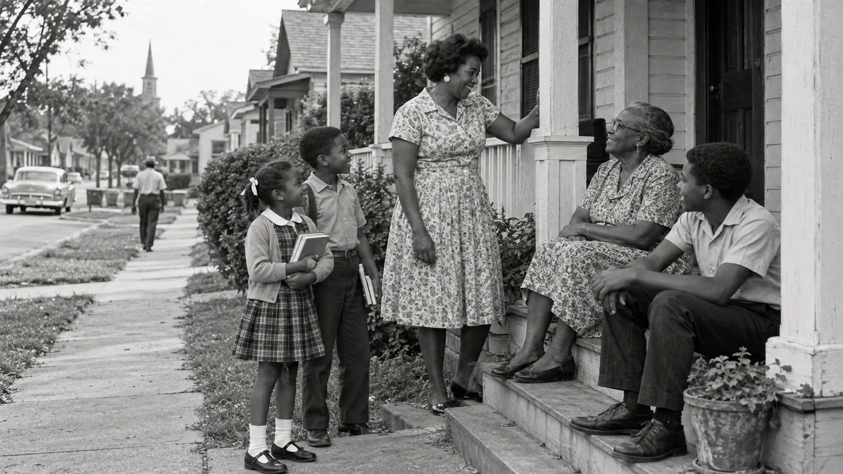
CHAPTER SEVEN · THE 1950s & 1960s
The years changed. Home still had a name.
Circa 1963 · Historical interpretation. Imagined neighbors; not a photograph of the Clay or Taylor families.
In 1956, Ed Davis High School closed. A chapter in Boston’s daily life came to an end.
The museum records the final graduating class in May and the move of students to Garth High School that fall. The change opened a new chapter in education. It also meant that a school which had gathered generations of Black students would no longer gather them in the same way.
It is possible to recognize the necessity of ending segregation and still understand why people remember the teachers, classmates, teams, and traditions of the school they lost.
As the 1950s gave way to the 1960s, the family story continued beyond the last yearbook and the last graduating class. The children named in census households grew older. Some would become the parents and grandparents through whom Boston is remembered today.
We cannot fill every intervening decade with a story we have not yet heard. The surviving records are uneven. But a gap in the archive is not a gap in the lives that were lived.
There are still photographs to identify, teachers to name, and family histories to bring back to their streets.
CHAPTER EIGHT · BOSTON, STILL
A place can change. It can still belong to you.
Today, Boston’s history can be followed through familiar places and names: Wayman Chapel on Chambers Avenue; the Ed Davis Learning Center and park; Young Street, Main Avenue, and Booker T. Avenue.
Some of the work is remembering. Some of it is as practical as reading a survey.
A survey recorded by Scott County on June 7, 2024, shows two tracts on the north side of Young Street and names Harry Taylor Jr. and Ella Clay Taylor as the owners in the survey. Tract 1 measures 0.12 acre and Tract 2 measures 0.29 acre, for a combined 0.41 acre. The survey cites Deed Book 152, page 757 as the source of title for both tracts.
The Georgetown News-Graphic reported on June 14, 2024, that the Taylors conveyed both Young Street tracts to BGAR Properties, LLC. The notice gives the same tract sizes as the survey.
A deed dated September 28, 1982, records the transfer of undivided interests in two Young Street lots to Harry Taylor Jr. and Ella Clay Taylor. Its property description traces both lots to a deed from Lovell Clay Sr. dated February 22, 1980, in Deed Book 150, page 509. The 1980 deed is the next record to examine.
That reference may help answer a question the family’s memory has brought us to: did this land include Lovell and Anna Lou Clay’s home?
We do not know yet. Their Young Street residence is documented; its exact house number and its connection to these tracts remain unresolved.
But now there is a place to look. And that is how a history like this keeps growing—not through one final discovery, but through the patience of people who believe their community is worth remembering.
Select a year to move through the story. Land, institutions, and family records provide the milestones.
WALK THE NEIGHBORHOOD
Every place has a story.
Explore recorded residences, community landmarks, and historical property leads on today’s street network.
N ↑Present-day county GIS · Historic boundaries not implied
Pins use modern address points. Historical street numbers, building footprints, and ownership may differ. “Study lead” means a secondary account still requires deed verification. Young Street’s Clay home has no exact pin until its address is established.
THE STORY IS STILL BEING TOLD
Say the names. Remember the streets. Keep the story.
Boston began taking shape in the years after slavery. What followed was the work of generations.
And generations later, someone can still point to a street and say: My people lived here.
This exhibit brings together census images, recorded surveys, historical maps, a Georgetown community-history study, and family testimony. It presents the story established so far; it is not a complete census of Boston or a completed chain of title.
Scott County Plat Finder · CAB13, pp. 355–355D — Young Street survey and legal descriptions, document 501902, recorded June 7, 2024. The plat labels both tract sizes, and the legal descriptions repeat the reference to Deed Book 152, page 757.
Scott County Deed Book 152, pp. 757–761 (1982). Exhibit A, p. 758, describes both lots and cites the 1980 conveyance from Lovell Clay Sr. Scott County Clerk land records ↗.
Georgetown history study supplied by the researcher, 39-page scan, section on the emergence and growth of African American urban communities. Secondary property accounts are labeled as study leads.
Family identifications supplied by Obie Taylor Sr.; census records independently support the cited residences.
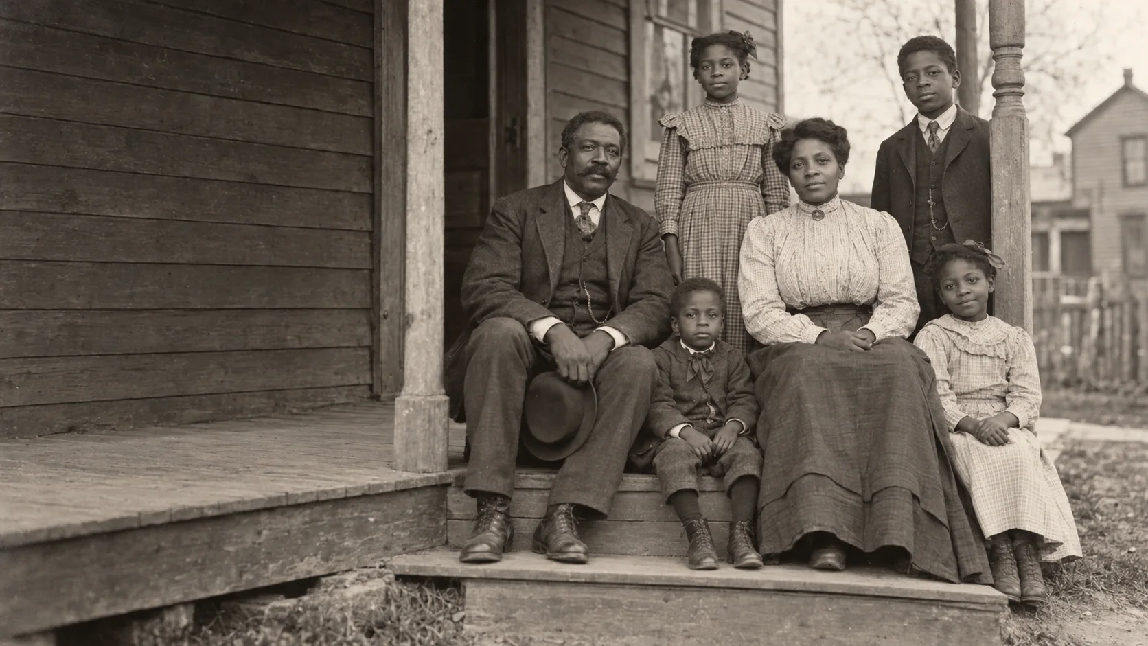
Created images: contemporary AI-generated photographic interpretations of circa 1895, 1925, and 1963. These are imagined people and settings, not archival photographs, verified family portraits, or exact reconstructions of Boston. Each is labeled at its point of use.
Interactive map: county GIS street geometry and modern address points, supplemented by cited historical records. No route crosses private property; this is a research map, not a guided-access plan.
Early land transaction: Georgetown history study cites DB 9:64 (1867); original deed not yet examined. School lot: study p.20, printed p.21, April 23, 1894, $900, DB 29:116. Wayman Chapel lot: same page, May 2, 1896, DB 30:460. These are secondary deed citations, not completed title examinations.
The school building date is reported inconsistently: the museum account says 1884, while the Kentucky Historical Society marker dates the school building to 1894. This exhibit follows the marker for the building date and leaves the earlier institutional chronology open.
Letcher residences and parent names come from the family research register’s census and death-certificate examination. The reported 1927 Brown Street purchase remains a secondary-study lead; the identity and parcel connection require verification.
Research and family-history contributions: Obie Taylor Sr. · Exhibit prepared for the Historic Lyric Theatre. Research continues on unresolved dates and historical parcel matches.